Rapa Nui now has a population of 6-7,000 (and 10,000 horses!), but in days gone by it was 15,000 or more, depending on which expert you ask. Apparently, the overpopulation and the resources required to sustain the obsession of bigger and bigger moai caused extreme deforestation and a massive breakdown in society in the 1700's, during which the population dropped to maybe 2-3,000 and the moai were toppled and vandalised. The situation got worse in the 1800's when Peruvian slave traders captured half the population and introduced smallpox etc.
In setting a schedule for our extended tour of Rapa Nui, Ata proved himself to be a showman - under the guise of guiding us through the various phases of island history and mythology, from the Polynesian arrival, through the irrational ma'oi years and then the crisis which followed, and finally the
birdman era, he artfully saved the best for last! Our last day on Rapa Nui was eye-popping, and answered many questions.
Tongariki
Ata drove us to the eastern end of Rapa Nui, to a spot somewhere between two volcanic caldera, called
Tongariki. The ahu here is stunning, the biggest on the island, with 15 restored mo'ai side by side. The mo'ai have their backs turned to the coast and face sunset on the summer solstice.
Only one of the 15 mo'ai sport a pukao on its head, but there are a number of pukao lying on the ground nearby. We don't know why the restoration team left them on the ground - may have been engineering problems, or maybe they didn't know which hat belonged to which statue.
This site has undergone even more disruption than most on Rapa Nui. Apart from the general destruction of
huri mo'ai, the toppling of all the mo'ai, around 1800, Tongariki's ruins were further scattered by the tsunami following the Valdivia (Chile) earthquake in 1960.
But then, Tongariki's restoration in the 1990's leading up to the spectacular sight we see today, was led by none other than Ata's father, Claudio Cristino from the University of Chile.
 In the caldera of Volcano Rano Raraku.
 Tongariki is halfway between two volcanoes, Rano Raraku and Poike.
 The incredible 15 ma'oi of Ahu Tongariki, behind the solitary "Wallking Mo'ai" which was possibly abandoned whilst en route to its ahu.
 Count them! All 15 mo'ai of Ahu Tongariki.
 The only mo'ai of Ahu Tongariki to have a scoria pukao on top.
 Leaden skies as Ata tells us of the 1960 tsunami which demolished the ruins of Ahu Tongariki.
 Viewed from Poike, the 15 mo'ai of Ahu Tongariki.
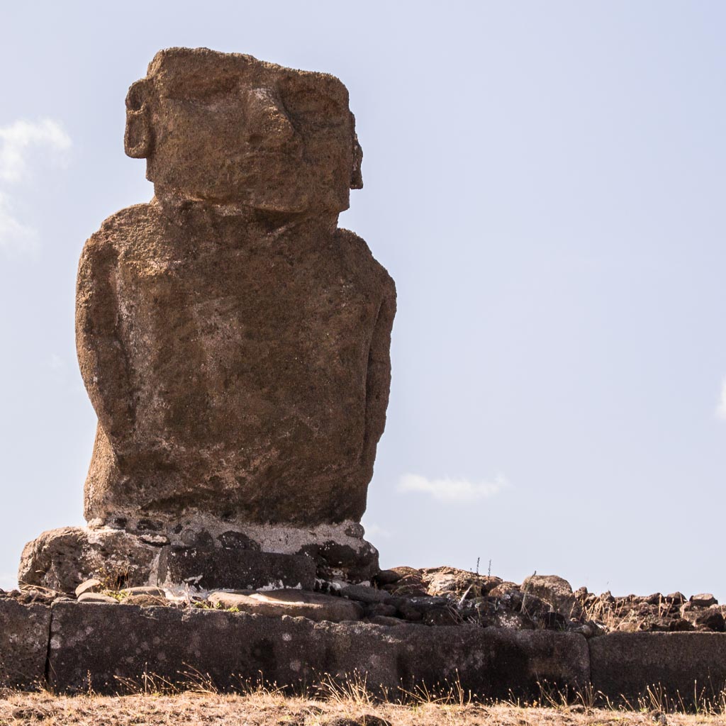
 From the south east, the back view of these 15 mo'ai.
 At the base of the ahu, Glenn shows us the sacle of these giant mo'ai.
 These must be the pukao from the Ahu Tongariki mo'ai.
 From any angle, the mo'ai of Ahu Tongariki are an amazing sight.
 Ahu Tongariki plus a row of disconnected pukao.
 This view begs the question - how did they get those pukao into position?
 The six of us on this Lindblad Rapa Nui tour, Dick, Clare, Mike, Glenn, Bob and Helene.
 From here came the tsunami. View of Ahu Tongariki from the slopes of Rano Raraku.
The secrets of mo'ai construction were revealed to us only 5 minutes drive from Tongariki, at
Rano Raraku. This volcano is the quarry for
tuff, the volcanic ash used to make most mo'ai. Here, we could see new mo'ai being carved directly from the exposed tuff in the ground, after which they were slid downhill and uprighted on a journey to their intended ahu. Many partly completed and relocated mo'ai are found abandoned on these slopes - they were not subjected to the toppling, and have remained upright.
Rather supporting the hypothesis that some determined competition between clans required progressively bigger and bigger mo'ai, the largest ever mo'ai are found partly completed but then abandoned at Rano Raruku. One is 21.6m tall, about 270t, twice the size of any other mo'ai.
 The slopes of Rano Raraku, half buried, incomplete mo'ai, abandoned during the crisis.
 Rano Raraku finally explains to visitors how the mo'ai were constructed.
 One of many mo'ai on the slopes of Rano Raruku.
 Tukuturi, the only bearded and kneeling mo'ai at the tuff quarry, but made of scoria! Another Rapa Nui mystery.
 Stunning, huge, partly carved mo'ai, abandoned in mid-construction.
 Ata, demonstrating the tools used to carve mo'ai.
 Some Rano Raruku mo'ai appear to have been abandoned because carving became too difficult.
On the north shore of Rapa Nui is
Anakena, one of only two sandy beaches on the rocky coasted island. It is probably the site of the earliest human settlemment on Rapa Nui, possibly as early as 300CE, but could be as late as 800CE. By tradition, Hotu Matu'a arrived in two canoes from (probably) the Marquesas, and became the ancestor of all Rapa Nui people. Being a beach, it probably made for an easy landing.
Hotu Matu'a picked a nice spot. The beach is beautiful (and popular), the water delightful, but it was frightfully windy on our visit. It reinforced our prior jocular remark that the real meaning of Rapa Nui is
place of incessant winds! We read that Anakena was one location used in the 1994 film "Rapa Nui".
Before Ata allowed us to have a swim, he showed us the ahu here with seven restored mo'ai (1978) on
Ahu Nau Nau, and the solitary
Ahu Ature. Some of the detail in petroglyphs is better preserved here than in other locations, possibly because the mo'ai were buried in protective sand.
 Clear petroglyphics on the backs of the mo'ai and the ahu platform.
 The broad and solitary mo'ai at Ahu Ature.
 The only mo'ai that you're actually allowed to touch!
 Four of the mo'ai at Ahu Nau Nau have their pukao on.
 These mo'ai have their backs to a stunning view of the Anakena beach.
 Surfing at the windswept beach of Anakena.
 A volcanic lava cave as seen from the water at Anakena.
Almost in the shadow of the built up end of the airport runway is
Vinapu, a large but unrestored site of fallen mo'ai and precise basalt stonemasonry which is (to archaeologists) evidence of Peruvian Inca influence (or is it vice versa?). The site dates around 1440.
 The precise assembly of basalt blocks here is unique.
 Ata's van parked nearby at Vinapu.
The
Rano Kau volcano, and on the edge of its caldera, the historical valliage of
Orongo, lie on the south western tip of Rap Nui. Here we learn (a) where the island's water comes from and (b) something of Rapa Nui's fascinating
birdman cult which followed the crisis of mo'ai toppling.
Orongo is a restored (1974) ceremonial stone village of sod-covered, windowless, almost doorless, circular buildings. These were used by clan appointed warriors (the birdmen) and priests preparing for a very dangerous annual race (1700's) to bring the first manutara (sooty tern) egg back intact from the nearby islet of Motu Nui.
The descent from Orongo to the water is a terrifying cliff, and Ata suggested that warriors died going this way, and that the more successful took a longer and more gentle route, followed by a much longer swim. The winning warrior earned special privileges for himself and his clan. Whether this competition replaced the environmental distaster of mo'ai construction, or coexisted with it, is uncertain. Ata suggested that the winner's privileges were frustrated by devious priests anyway.
The whole birdman tradition was put to an end by Christian missionaries, horrified by naked pagan rituals, in the mid 1800's, and replaced it with slavery and disease. To add insult to injury, a huge mo'ai
Hoa Hakananai'a at Orongo was stolen by the British in 1868. It's now lives in the British Museum where, at least, it will be very well protected.
 View from Orongo of Motu Nui, with the smaller Motu Iti in front and the isolated sea stack of Motu Kau Kau in-between.
 The restored village at Orongo where warriors and priests would reside during the annual birdman race.
 Birdman petroglyph on the rim of Rano Kau.
 Stream of visitors to Orongo and Rano Kau.
 Drawing of Birdman Warrior, at the Orongo visitors centre.
 All that remains of the Hoa Hakananai'a mo'ai from Orongo, an image in the visitor's centre.
From near Orongo, one can look into the amazing and beautiful caldera of Rano Kau. It's full of marshy water and is, apparently, Rapa Nui's main water supply. If so, it is a fragile source. Ata points out that the caldera rim is deteriorating and eventually it will fail and drain the water into the sea. There are other volcanic lakes, though.
 The spectacular caldera of volcano Rano Kau.
 How reliable is this as a fresh water source for Rapa Nui?
 The NG-Panorama II, launched in 2004, is a 50m two-masted sailing ship particularly equipped for itineraries in warm climates.
 The 46m 630 ton NG-Sea Lion built in 1982 was extensively refurbished in 2015.
 The 72m 2716ton NG-Endeavour II was launched in 2005, renovated in 2016, and is currently devoted to Galapagos expeditions.


![[1]](http://www.waymarker.co.uk/ml/rapanui/map.jpg)