Showing posts with label Claudio Cristino. Show all posts

22 February, 2016

Homeward Bound...


And so, our time on Rapa Nui has come to an end. In fact, so has this entire trip, to Chile, the southern tip of Argentina, the Antractic Pensinsula, the Orkneys, South Georgia and the Falklands too. Experientially, this must have been our best ever holiday. Nowhere else have we been so astounded, and seen so much that is new.
This map, by Eric Gaba (see citation below), had red spots to show the sites we visited. It also shows the approximate location of our Explora Hotel.

Fruit in the bowl at Explora.

Rapa Nui wildflowers.


Getting back to Rapa Nui, our fabulous guide, Ata, dwelled on the past, as he was probably paid and expected to do, and didn't show us much of the current Rapa Nui. In retrospect, we should probably have spent another day on Rapa Nui - the Explora Hotel was certainly pleasant enough! - so we could walk around the town of Hanga Roa and visit the marina, to see what present day Rapa Nui is like, and also to relax a bit and better enjoy the hotel facilities!
Cooling off in the Explora infinity pool, after a hot day on the road with Ata.


Is there anywhere else in the world that is more remote than Rapa Nui, or whose history is so interesting but shrouded in mystery? For these reason alone, this little volcanic island is worth a visit. We are very pleased to understabd that the restoration projects undertaken by William Mulloy and Claudio Cristino and others from 1955 have reawakened the Rapa Nui population's self-esteem and pride in their vital contribution to Polynesian history, and, apparently, transformed the island and its place in the world.

This reinvention seems to have led to the annual Tapati Festival, organised "by locals for locals", as a celebration of Rapa Nui's past. We just missed this Festival - it was held from 29Jan - 14Feb 2016, finishing barely a day or two before our arrival. The Festival, which would be wonderful to see, consists of a variety of locally relevant traditional events such as Haka Pei, where contestants slide down a steep hill at treacherous speeds, 80km/hr, on banana trunks. There is horse racing (apparently the gaucho style of riding from South America is popular), a triathlon (run, swim, canoe), and dance competitions. For Tapati, the populace splits into two clans representing the divisions of the original Polynesian arrivals. Fortunately, the destructive competition between clans of the past is replaced by peaceful endeavours which must, for Rapa Nui, be akin to nation building.
Two posters seen at the Explora. The '94 poster may be a reference to a movie that year. The other poster is for the annual Tapati cultural festival, organised "by locals for locals".

Promotional material for the 2016 Tapati Festival. Bare feet - it looks like a tough event.


And our visit causes us to reflect on the anthropogenic environmental disaster that caused Rapa Nui society to fail in the mid 1700's. Irrational competition to produce ever-larger mo'ai so diminished resources on Rapa Nui destroyed tree species to the extent that the natives could not build canoes for fishing. The absence of trees degraded the topsoil and farming failed. The island could not sustain itself. Overpopulation was the result and led to isurrection and clan wars, mo'ai were toppled in huri mo'ai, and the population was reduced to a fraction. Is this behaviour any different to what is happening in our society today, where city developers seem to prevail over saner heads seeking less growth and sustainable solutions? Where never-ending growth is the target regardless of a finite planet? Where money rules over science? What have we learned? Are we any better?
View over Hanga Roa and Mataveri airport. The airport was improved by NASA so it could be available for possible Pacific rescue missions from its space program.

Getting the windows cleaned at our Santiago hotel on our last day in Chile.


Back to Santiago, then the Qantas QF28 flight home presumably followed a Great Circle from Santiago (SCL) to Sydney (SYD) to minimise the distance flown. This route sent us way down south towards Antarctica, and south of New Zealand, as confirmed by the Flight Map on the plane's entertainment system when viewed at various times. We never saw Antarctica from the window because, apart from trying to sleep, we were probably a bit too far north and it was very cloudy anyway.
Spectacular view of Chilean volcano from QF28 as we headed south on the great circle route to Sydney.

The great circle route from Santiago to Sydney goes well south!


Rapa Nui map By Eric Gaba (Sting), translated by Bamse - Own work. Shorelines, ponds, roads, trails and airport drawn using Landsat 7 ETM+ imagery (public domain);Topography: NASA Shuttle Radar Topography Mission (SRTM3v2) (public domain);Main references used for the toponymy:prof. William Mulloy's map (easier to read here);Pacific Island Travel map (http://www.pacificislandtravel.com/easter_island/about_destin/isla_de_pascua[1].jpg);[1], CC BY-SA 2.5, https://commons.wikimedia.org/w/index.php?curid=2940588

21 February, 2016

Towards Birdman...


Rapa Nui now has a population of 6-7,000 (and 10,000 horses!), but in days gone by it was 15,000 or more, depending on which expert you ask. Apparently, the overpopulation and the resources required to sustain the obsession of bigger and bigger moai caused extreme deforestation and a massive breakdown in society in the 1700's, during which the population dropped to maybe 2-3,000 and the moai were toppled and vandalised. The situation got worse in the 1800's when Peruvian slave traders captured half the population and introduced smallpox etc.

In setting a schedule for our extended tour of Rapa Nui, Ata proved himself to be a showman - under the guise of guiding us through the various phases of island history and mythology, from the Polynesian arrival, through the irrational ma'oi years and then the crisis which followed, and finally the birdman era, he artfully saved the best for last! Our last day on Rapa Nui was eye-popping, and answered many questions.

Tongariki

Ata drove us to the eastern end of Rapa Nui, to a spot somewhere between two volcanic caldera, called Tongariki. The ahu here is stunning, the biggest on the island, with 15 restored mo'ai side by side. The mo'ai have their backs turned to the coast and face sunset on the summer solstice.

Only one of the 15 mo'ai sport a pukao on its head, but there are a number of pukao lying on the ground nearby. We don't know why the restoration team left them on the ground - may have been engineering problems, or maybe they didn't know which hat belonged to which statue.

This site has undergone even more disruption than most on Rapa Nui. Apart from the general destruction of huri mo'ai, the toppling of all the mo'ai, around 1800, Tongariki's ruins were further scattered by the tsunami following the Valdivia (Chile) earthquake in 1960.

But then, Tongariki's restoration in the 1990's leading up to the spectacular sight we see today, was led by none other than Ata's father, Claudio Cristino from the University of Chile.
In the caldera of Volcano Rano Raraku.

Tongariki is halfway between two volcanoes, Rano Raraku and Poike.

The incredible 15 ma'oi of Ahu Tongariki, behind the solitary "Wallking Mo'ai" which was possibly abandoned whilst en route to its ahu.

Count them! All 15 mo'ai of Ahu Tongariki.

The only mo'ai of Ahu Tongariki to have a scoria pukao on top.

Leaden skies as Ata tells us of the 1960 tsunami which demolished the ruins of Ahu Tongariki.

Viewed from Poike, the 15 mo'ai of Ahu Tongariki.

From the south east, the back view of these 15 mo'ai.

At the base of the ahu, Glenn shows us the sacle of these giant mo'ai.

These must be the pukao from the Ahu Tongariki mo'ai.

From any angle, the mo'ai of Ahu Tongariki are an amazing sight.

Ahu Tongariki plus a row of disconnected pukao.

This view begs the question - how did they get those pukao into position?

The six of us on this Lindblad Rapa Nui tour, Dick, Clare, Mike, Glenn, Bob and Helene.

From here came the tsunami. View of Ahu Tongariki from the slopes of Rano Raraku.


Rano Raruku

The secrets of mo'ai construction were revealed to us only 5 minutes drive from Tongariki, at Rano Raraku. This volcano is the quarry for tuff, the volcanic ash used to make most mo'ai. Here, we could see new mo'ai being carved directly from the exposed tuff in the ground, after which they were slid downhill and uprighted on a journey to their intended ahu. Many partly completed and relocated mo'ai are found abandoned on these slopes - they were not subjected to the toppling, and have remained upright.

Rather supporting the hypothesis that some determined competition between clans required progressively bigger and bigger mo'ai, the largest ever mo'ai are found partly completed but then abandoned at Rano Raruku. One is 21.6m tall, about 270t, twice the size of any other mo'ai.
The slopes of Rano Raraku, half buried, incomplete mo'ai, abandoned during the crisis.

Rano Raraku finally explains to visitors how the mo'ai were constructed.

One of many mo'ai on the slopes of Rano Raruku.

Tukuturi, the only bearded and kneeling mo'ai at the tuff quarry, but made of scoria! Another Rapa Nui mystery.

Stunning, huge, partly carved mo'ai, abandoned in mid-construction.

Ata, demonstrating the tools used to carve mo'ai.

Some Rano Raruku mo'ai appear to have been abandoned because carving became too difficult.


Anakena

On the north shore of Rapa Nui is Anakena, one of only two sandy beaches on the rocky coasted island. It is probably the site of the earliest human settlemment on Rapa Nui, possibly as early as 300CE, but could be as late as 800CE. By tradition, Hotu Matu'a arrived in two canoes from (probably) the Marquesas, and became the ancestor of all Rapa Nui people. Being a beach, it probably made for an easy landing.

Hotu Matu'a picked a nice spot. The beach is beautiful (and popular), the water delightful, but it was frightfully windy on our visit. It reinforced our prior jocular remark that the real meaning of Rapa Nui is place of incessant winds! We read that Anakena was one location used in the 1994 film "Rapa Nui".

Before Ata allowed us to have a swim, he showed us the ahu here with seven restored mo'ai (1978) on Ahu Nau Nau, and the solitary Ahu Ature. Some of the detail in petroglyphs is better preserved here than in other locations, possibly because the mo'ai were buried in protective sand.
Clear petroglyphics on the backs of the mo'ai and the ahu platform.

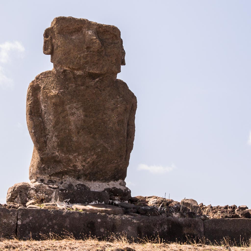
The broad and solitary mo'ai at Ahu Ature.

The only mo'ai that you're actually allowed to touch!

Four of the mo'ai at Ahu Nau Nau have their pukao on.

These mo'ai have their backs to a stunning view of the Anakena beach.

Surfing at the windswept beach of Anakena.

A volcanic lava cave as seen from the water at Anakena.


Vinapu

Almost in the shadow of the built up end of the airport runway is Vinapu, a large but unrestored site of fallen mo'ai and precise basalt stonemasonry which is (to archaeologists) evidence of Peruvian Inca influence (or is it vice versa?). The site dates around 1440.
The precise assembly of basalt blocks here is unique.

Ata's van parked nearby at Vinapu.


Orongo and Rano Kau

The Rano Kau volcano, and on the edge of its caldera, the historical valliage of Orongo, lie on the south western tip of Rap Nui. Here we learn (a) where the island's water comes from and (b) something of Rapa Nui's fascinating birdman cult which followed the crisis of mo'ai toppling.

Orongo is a restored (1974) ceremonial stone village of sod-covered, windowless, almost doorless, circular buildings. These were used by clan appointed warriors (the birdmen) and priests preparing for a very dangerous annual race (1700's) to bring the first manutara (sooty tern) egg back intact from the nearby islet of Motu Nui.

The descent from Orongo to the water is a terrifying cliff, and Ata suggested that warriors died going this way, and that the more successful took a longer and more gentle route, followed by a much longer swim. The winning warrior earned special privileges for himself and his clan. Whether this competition replaced the environmental distaster of mo'ai construction, or coexisted with it, is uncertain. Ata suggested that the winner's privileges were frustrated by devious priests anyway.

The whole birdman tradition was put to an end by Christian missionaries, horrified by naked pagan rituals, in the mid 1800's, and replaced it with slavery and disease. To add insult to injury, a huge mo'ai Hoa Hakananai'a at Orongo was stolen by the British in 1868. It's now lives in the British Museum where, at least, it will be very well protected.
View from Orongo of Motu Nui, with the smaller Motu Iti in front and the isolated sea stack of Motu Kau Kau in-between.

The restored village at Orongo where warriors and priests would reside during the annual birdman race.

Birdman petroglyph on the rim of Rano Kau.

Stream of visitors to Orongo and Rano Kau.

Drawing of Birdman Warrior, at the Orongo visitors centre.

All that remains of the Hoa Hakananai'a mo'ai from Orongo, an image in the visitor's centre.


From near Orongo, one can look into the amazing and beautiful caldera of Rano Kau. It's full of marshy water and is, apparently, Rapa Nui's main water supply. If so, it is a fragile source. Ata points out that the caldera rim is deteriorating and eventually it will fail and drain the water into the sea. There are other volcanic lakes, though.
The spectacular caldera of volcano Rano Kau.

How reliable is this as a fresh water source for Rapa Nui?

19 February, 2016

Off to Easter Island...


Six of us from the Orion took the Lindblad extension package to Easter Island. The Holiday Inn Express at the airport would not store baggage for non-returning guests for over 24 hours (some restrictive trade agreement with the airport), so the Lindblad representative assisted by taking us to the Left Luggage office at Sandiago airport - we didn't want to take all our cold weather gear to tropical Easter Island!

The flight to Easter Island (SCL - IPC) was an almost 5 hour epic on a brand new LAN 787-9 Dreamliner - these are wonderful new airliners compared to the clunky old Boeing Jumbos that Qantas seem to rely on. If we had realised how long this flight was, and in the general direction of Australia, we might have considered an alternate route home, from Easter Island, to Papeete and then Sydney. That would've saved 10 hours extra flying time, nothing to be sneezed at, and we might even have managed a holiday in Tahiti! But, we didn't think of that when we planned this trip and made the flight bookings.
This is the flight path we could/should have taken home, but instead, our bookings have us returning to Santiago.


Easter Island has an amazing story to tell. Firstly, it is the most remote inhabited island in the world, being over 2000km from Pitcairn Island. It is a special territory of Chile, and since 1995, has been named as a UNESCO World Heritage site thanks to its famous and mysterious statues, known as mo'ai or ma'oi, built by the Rapa Nui people and tall, averaging about 4m high. The island is quite small, 164sq.km and has a current poulation of 6-7,000.
The airport runway near the south west corner of Rapa Nui conveys the scale of this island.


Lindblad didn't send an expedition specialist with us, but recruited a local guide, Ata, a well educated and extremely knowledgeable guy with part Italian heritage. We were to learn from Ata, and by our own reading, that almost everything about Easter Island's history is hotly contested, and sometimes mythology seems more dominant than demonstrable facts. We don't know of any peoples whose past is so uncertain! The trouble is, the inhabitants left little in the way of written records - petroglyphs are mostly spiritual. Oral story-telling traditions seem to be poor and variously aid or conflict with carbon dating and scientific research.

Ata's father is Claudio Cristino, an archaeologist from the University of Chile and a co-founder of the Easter Island and Oceania Studies Centre. He has worked on the restoration of Rapa Nui sites. Ata said he didn't follow his father's footsteps in academia, but by doing this job, he is clearly doing his bit to propagate Rapa Nui's fascinating history to the world. Claudio is listed on Lindblad's website as a staff Cultural Specialist. Ata comes with a good pedigree!

The island we call Easter Island has many names. The Easter name was given by Dutch explorer Jacob Roggeveen when he arrived here on Easter Sunday, 1722. Our flight didn't come to Easter Island though, the official destination was the Spanish version Isla de Pascua, and Mataveri Airport's code is IPC . The local population call the island Rapa Nui, which means "Big Rapa", after, apparently, its resemblance to the smaller island of Rapa further west in the Pacific Ocean. But that's not the end of its names - there is Te pito o te kainga a Hau Maka which may mean "this little piece of land of Hau Maka, but the word "pito" also translates as "navel" which leads to an alternate meaning, "the Navel of the World". Such ambiguities are just the beginning on this island which we will respectfully refer to as Rapa Nui in posts to this blog.

Between the years 700 and 1100, Polynesian people first came to Rapa Nui from the Gambier Islands (2,600km away) and the Marquesas Islands (3,200km) in catamarans and canoes - these guys were no mean sailors! - and on these flimsy vessels they carried all the means to extend their traditional islander civilisations. The popularity of sweet potatoes (a South American vegetable) amongst Polynesians suggests that at least some migration to here (and other islands) came from the east.

Regardless, Ata explained to us that the arriving peoples brought Polynesian traditions with them, but were determined to shape and vary them in particular ways. This is no doubt true, and explains differing Polynesian cultures in all their locations. Several clans arrived here. The big mystery on Rapa Nui is why the clans here developed idolatory to a ridiculous extent and competition between them brought about their own destruction. Ata set about telling us this story, but it proved to be hard to separate fact from myth!

Ahu Tahai

Our first exposure to all of this was Ahu Tahai in the Rapa Nui National Park, quite near Hanga Roa, the only town on the island. All the mo'ai in Rapa Nui were destroyed in a crisis about which were are yet to learn, but Tahai (and other sites) had been restored by an American archaeologist, the late Dr. William Mulloy in 1972. The site has a number of erect mo'ai, all facing away from the sea, including five on a single altar, an ahu. UNESCO has apparently directed that most sites be NOT restored, but be left as they were found.
Mo'ai rest on altars, known as ahu.

Mulloy re-erected five mo'ai on their ahu here at Tahai, but most are in poor shape. Neck breaks have been visibly repaired.


We learned a lot on this first visit. The mo'ai, Easter Island Heads, are statues of men in which the head is disproprtionately large compared to the body, and don't have legs. This constant theme is no doubt symbolic, and maybe partly due to practical reasons. They (mostly) all face inland, supposedly guarding clan lands. The statues are made from blackish soft volcanic ash (tuff), but their heads are topped with a different material, a reddish coloured rock called scoria. Almost all mo'ai now have empty eye sockets, but one at Tahai has had its eyes restored - these are made from obsidian, and have particular sacred powers.
A restored mo'ai, complete with scoria hat and obsidian eyes.


A memorial to Mulloy at Tahai acknowledges his contribution to Rapa Nui. In part it says "by restoring the past of his beloved island, he also changed its future". Ata explained the truth of this statement, how the restoration has delivered pride and self esteem to the Rapa Nui population.
A raging surf rolls in on the north-east coast of Rapa Nui at Tahai.

There's a very small rocky beach at Tahai, enjoyed by a few sunbakers and determined swimmers. This area looks like a sort of port.


Ata taught us that carving, moving and erecting the mo'ai depleted the resources of Rapa Nui, a situation which got worse as apparent competition between the clans caused the mo'ai to get bigger and bigger. The fact that the mo'ai were all destroyed later in some crisis suggests that the people identified and protested against this folly, but were apparently powerless to influence the leadership, the Rapa Nui royalty. It seems that the powerful were far more concerned with death, and possibly the afterlife, than in sustaining the living!
Most mo'ai were pushed over and broken during a crisis.

Ata showing us the foundations of canoe shaped shelter at Tahai. It would have been used for sleeping and storage, but cooking and living would be outside. The tiny entrance at the right.